
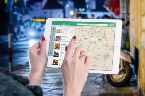
Step into the world of navigation apps, where virtual roads unfold before your eyes and electronic maps guide your every move. These innovative companions, led by the ever-popular Google Maps, have revolutionized the way we navigate through bustling cities and uncharted territories. But hold on, dear traveler, for there are more treasures to uncover beyond the familiar paths of Google. Let us embark on a journey to explore the untamed realms of GPS and navigation apps, where each app paints a unique picture of the world, offering a distinct blend of features and delights. So buckle up, Android adventurers, as we embark on a quest to discover the hidden gems that lie within the realms of GPS and navigation apps.
Features and Functions of GPS Navigation:
- Accurate directions: GPS navigation apps are renowned for their ability to provide precise turn-by-turn directions, ensuring that you reach your destination efficiently and without unnecessary detours.
- Real-time traffic updates: Stay one step ahead of the bustling currents of traffic with real-time updates offered by navigation apps. These apps harness the power of data to keep you informed about traffic conditions, allowing you to avoid congested areas and choose the fastest routes available.
- Voice-guided navigation: Bid farewell to constantly glancing at your device with voice-guided navigation. These apps enchant you with soothing voices that guide your every turn, enhancing both safety and convenience on your journey.
- Alternative route suggestions: Should unexpected hurdles emerge along your path, fear not! GPS navigation apps have a magical ability to conjure alternative routes. Whether it’s a traffic jam, an accident, or a road closure, these apps swiftly offer alternative paths, ensuring that you reach your destination on time.
- Points of interest: Unlock a treasure trove of information about the world around you with navigation apps that showcase nearby points of interest. Whether you’re seeking a cozy restaurant, a convenient gas station, or a majestic landmark, these apps unveil a plethora of options, allowing you to embark on exciting adventures and discover hidden gems.
- Offline maps: Step into areas with limited connectivity without fear, as some GPS navigation apps offer the power of offline maps. With pre-downloaded maps at your fingertips, you can navigate remote locations, traverse winding roads, and explore uncharted territories without relying on an internet connection.
- Integrated reviews and ratings: Embrace the wisdom of the crowd with navigation apps that integrate reviews and ratings for various locations. These insights enable you to make informed decisions about places to visit, ensuring that every experience on your journey exceeds expectations.
- Multi-modal navigation: Adapt to the diverse landscapes of your adventure with navigation apps that cater to various transportation modes. Whether you prefer walking, cycling, or utilizing public transportation, these apps offer options to accommodate your individual preferences, seamlessly guiding you across different terrains.
- Customization features: Personalize your navigation experience with apps that grant you the power to customize your preferences. Avoid toll roads, highways, or specific areas according to your desires, creating a tailored journey that aligns with your unique needs.
- Safety features: Prioritize safety on your travels with GPS navigation apps that provide essential safety features. From speed limit warnings to lane guidance, these apps serve as virtual guardians, ensuring that you adhere to road regulations and navigate with caution.
- Integration with other apps: Seamlessly blend your navigation experience with other digital realms through the integration of navigation apps with various platforms. Access your favorite music streaming services, messaging apps, or ride-sharing services without leaving the navigation app, enabling you to stay connected throughout your journey.
- Trip planning and sharing: Embrace the spirit of collaboration and coordination with navigation apps that facilitate trip planning and sharing. Plan your itinerary, save your favorite routes, and share them with fellow travelers, creating a collective experience that amplifies the joy of exploration.
Top 13 Apps for GPS and Navigation Assistance:
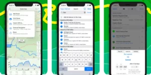
1. Google Maps
Price: Free
Main benefits: User-friendly, reliable, updated often
Available on: Mac, PC, Android, iOS
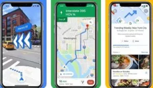
Google Maps, the reigning champion among free map applications, captivates users with its extensive features and user-friendly interface. Offering satellite imagery, 360° street view with augmented reality, and multi-modal route planning options, it has become synonymous with reliable navigation, It offers real-time traffic updates, seamless integration with music streaming services and Google Assistant, ability to share trip progress, and the AI-powered “explore tab” offering personalized recommendations.
While Google Maps offers numerous advantages and is completely free to use, it does have limitations. For example, when planning a trip with multiple stops, the app will find the best route from one point to next, but it lacks the capability to optimize the entire route. Besides, the app restricts the number of stops to a maximum of ten.
Pros:
- Versatility: Works for various forms of transportation, accommodating the needs of pedestrians, drivers, cyclists, and public transportation users.
- Real-time traffic information: Keeps users informed about traffic issues, allowing them to choose the most efficient routes.
- Departure and arrival times: Provides estimated arrival times based on real-time traffic conditions, ensuring better trip planning.
- Automatic rerouting: Adjusts routes on the fly to account for traffic, accidents, or other road conditions.
- Offline functionality: Allows users to access maps and directions even without an internet connection.
Cons:
- Limited social media sharing: Lacks a built-in function for sharing locations or routes on social media platforms.
- Occasional issues with directions: Some users have reported instances of missing or incorrect turn-by-turn directions, leading to missed exits or confusion.
- Battery drain: Continuous use of GPS can drain the phone’s battery at a faster rate.
- Rerouting limitations: In certain situations, Google Maps may redirect users back to the original route, even if a new route would be more efficient.
- App update issues: Some users have mentioned concerns with app updates, including the removal of features like upcoming turns and automatic route adjustments due to accidents.
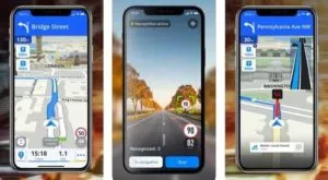
2. Waze
Price: Free
Main benefits: Real-time data, speed control, parking notifications
Available on: Mac, PC, iOS, Android
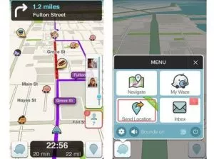
Another gem in the Google family, Waze shines as a navigation app with a specific focus on car trips. While sharing some similarities with Google Maps, Waze distinguishes itself by providing more advanced real-time data on traffic conditions, road closures, and other pertinent information.
Designed with a sleek and minimalist interface, Waze offers a delightful user experience with a high level of customization options. Tailor the app to your preferences and make it truly your own. Similar to Google Maps, this a also has limitations when it comes to route planning with multiple stops. However, it can serve as a valuable navigation system for field salespeople, allowing them to integrate it into their route planners for efficient daily tasks.
Pros:
- Real-time Traffic Updates: Stay informed about accidents, construction, police presence, road closures, and other traffic-related incidents in real-time. This valuable information empowers you to make informed decisions and choose alternative routes when necessary.
- Community Editors: Waze thrives on the collaborative efforts of its community. Community editors actively update and maintain the maps, ensuring that the information remains accurate and up-to-date.
- Gas Price Sharing: Waze goes the extra mile by allowing users to share current gas prices. This handy feature helps you find the best deals and save some money at the pump.
- Social Integration: Connect Waze with your Facebook account and let your friends know about your location through timeline posts. Share your adventures and coordinate meetups effortlessly.
- Time-saving Efficiency: Waze excels at finding the most efficient routes based on real-time traffic conditions. It saves you valuable time and ensures smoother and more seamless journeys.
- Personalized Experience: As you use the app, Waze learns from your patterns and preferences. It becomes attuned to your frequently used routes, preferred destinations, and commuting hours, providing a personalized navigation experience.
Cons:
- Cluttered Icons: The presence of icons for roadwork and other obstructions on the map can sometimes clutter the view, potentially obscuring your visibility and making it harder to navigate.
- Distractions from Social Aspects: The social features of Waze, while fun and engaging, can be distracting if you receive a high volume of notifications with sounds. It’s important to strike a balance and manage your notifications to maintain focus while driving.
- Battery Drain: Due to its continuous updating with new information, Waze can be a drain on your phone’s battery life. It’s advisable to have a reliable power source or use power-saving settings to mitigate this issue.
3. HERE WeGo
Price: Free
Main benefits: Available offline, real-time traffic information
Available on: iOS, Android
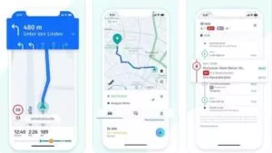
In the realm of GPS apps, HERE WeGo emerges as a strong contender, offering a range of features that are both reliable and convenient. Like its counterparts, it analyzes and compares various routes to find the best one available, ensuring optimal navigation experiences.
However, what sets HERE WeGo apart is its extensive offline map functionality. With offline maps available for over 100 countries worldwide, you can confidently rely on it even when you find yourself without an internet connection. This feature proves invaluable in situations where connectivity may be limited or unreliable.
One noteworthy aspect of HERE WeGo is its emphasis on urban areas. The app provides comprehensive traffic and parking data, enabling users to plan their journeys efficiently, particularly for tasks such as order pickups or deliveries. By accessing information about traffic conditions and parking availability beforehand, users can make informed decisions and optimize their routes.
Pros:
- Global Offline Usage: HERE WeGo stands out by offering offline usability worldwide. With offline maps at your disposal, you can navigate through unfamiliar territories without worrying about a stable internet connection.
- Convenient Location Management: The app allows you to save frequently visited locations in collections, streamlining your navigation experience and making it easier to access your preferred destinations.
- Traffic Information: HERE WeGo keeps you informed about traffic conditions, helping you navigate congested areas and make smart routing decisions to save time.
Cons:
- Reported Issues after Update: Users have reported issues with certain offline functions, such as search and accurate routing, following an update in 2021. It’s important to stay informed about potential updates and user feedback to gauge the performance of the app.
- Presence of Ads: Advertisements may appear within the app, which can be a minor inconvenience for some users. However, it’s important to note that ads help support the development and maintenance of the app.
- Full-Screen Compatibility: Some smartphone models may not display the maps in full-screen mode, potentially limiting the viewing experience. This aspect may vary depending on the device you are using.
4. Maps.me
Price: Free
Main benefits: Updated often, available offline
Available on: iOS, Android, Blackberry
For delivery drivers seeking a GPS app that optimizes battery usage, Maps.me proves to be a valuable choice. With full offline availability, this app significantly prolongs device battery life compared to other navigation apps.
One notable advantage of Maps.me, particularly for delivery services, is its crowd-sourced map updates. With millions of individual users contributing daily, the app ensures highly reliable and up-to-date maps for accurate navigation. However, it’s important to consider the drawbacks. Businesses on the map may not be updated frequently, which can result in outdated information. Additionally, when a turn is missed, the app can be slow in generating a new route.
Pros:
- Feature-rich: Maps.me offers an extensive range of features, including auto-follow mode, turn-by-turn directions, and real-time traffic data, enhancing the overall navigation experience.
- Full Offline Functionality: Users can enjoy complete offline functionality, enabling them to search for locations, navigate, and find places like restaurants or ATMs without an internet connection.
- Location Sharing: When online, Maps.me allows users to share their location with friends, promoting seamless coordination and communication.
- Battery Efficiency: As an offline app, Maps.me consumes less battery power compared to background-running navigation apps, ensuring prolonged device usage.
Cons:
- Infrequent Business Updates: Users have noted that businesses on the maps are not updated regularly, potentially leading to outdated information regarding establishments.
- Performance Issues: Some users have reported slow loading times, a difficult-to-use interface, and challenges in reading maps, which may impact the overall user experience.
5. CoPilot GPS
Price: Starting at $14.99 per year
Main benefits: Customizable for your vehicle type, available offline
Available on: iOS, Android
CoPilot GPS is another excellent option, particularly for delivery services, offering customizable routes based on vehicle type and accommodating considerations such as road width and low clearance. The app provides a range of features, including a search function, audio navigation, traffic information, and 3D maps. However, access to premium features and worldwide maps requires a subscription, with pricing varying based on features and vehicle type.
Pros:
- Customizable Routes: CoPilot GPS allows users to customize routes based on their specific vehicle type, considering factors like road width and low clearance. This feature is particularly valuable for delivery drivers navigating various vehicle sizes.
- Offline Location Search: The app can be used offline to search for locations, including restaurants, enhancing convenience in areas with limited internet connectivity.
- Premium Features: The premium version of CoPilot GPS offers additional benefits such as audio navigation, real-time traffic information, and detailed 3D maps. These features contribute to a comprehensive and enjoyable navigation experience.
- Worldwide Usage: CoPilot GPS works worldwide with an additional subscription, providing flexibility for users traveling across different regions.
Cons:
- Premium Subscription Costs: Access to premium maps and traffic subscriptions comes at a cost, ranging from $5.99 to $119.99 per item. Users should evaluate their navigation needs and budget when considering the premium features.
- Performance Concerns: Some reviewers have highlighted instances where routes did not adequately consider the requirements of large vehicles, along with occasional issues with the search function and app loading times or crashes. These concerns should be taken into account when assessing the app’s suitability.
6. Roadtrippers
Price: Free
Main benefits: Instant fuel cost estimation, explore based on categories
Available on: Mac, PC, Android, iOS
Roadtrippers is an exceptional navigation app for planning unforgettable road trips, with over 25 million trips planned and 7.8 billion miles covered. Its user-friendly interface and extensive features make it a top choice for explorers.
Discovering new places is a breeze with Roadtrippers. The app offers an intuitive and engaging planning process that allows you to map your route from point A to B. Additionally, it suggests exciting places to explore within a specified distance from your route and helps you find accommodations along the way. Seamlessly sync with your preferred GPS app, such as Google Maps, for smooth navigation during your trip. This app enables you to create a route with up to 7 stops at no cost. However, for more extensive road trips, an upgrade to Roadtrippers Plus is available.
PROS:
- Road Trip Planning: Roadtrippers excels in helping you plan your road trip route and discover exciting places to stop along the way. Its comprehensive features facilitate a customized and memorable journey.
- Turn-by-Turn Directions: The app provides clear and precise turn-by-turn directions to guide you along your chosen route, ensuring a smooth and hassle-free travel experience.
- Pre-Planned Routes and Trip Guides: Roadtrippers offers pre-planned routes and trip guides that include recommendations for restaurants and sightseeing spots. This feature enhances your travel experience by providing curated ideas for a more enjoyable journey.
- Cross-Device Syncing: Saved routes and sites sync seamlessly across multiple devices, allowing for convenient access to your plans wherever you go.
CONS:
- Roadtrippers Plus Subscription: For road trips with more than 7 waypoints, a subscription to Roadtrippers Plus is necessary. The cost for Roadtrippers Plus is $6.99 per month or $29.99 per year. Users should consider their itinerary and budget when deciding on the subscription.
- Limited Content Availability: Roadtrippers primarily focuses on road trips in the USA, Canada, Australia, and New Zealand. Users planning trips outside these regions may find the content availability limited.
- Route Selection Challenges: Some users have reported difficulties in selecting or changing routes within the app. This aspect should be taken into account when using Roadtrippers for trip planning.
7. Mapquest
Price: Free
Main benefits: Find the best gas prices, create custom maps
Available on: iOS, Android, Windows Phone
MapQuest is a free GPS app that offers a range of features to enhance your driving experience. With its interactive map, you can easily discover nearby hotels, gas stations, grocery stores, and more. The app provides real-time traffic data, including information on traffic slowdowns, incidents, and webcams.
One of the standout features is its ability to optimize routes with up to 26 stops, ensuring that you save time and money on gas by finding the most efficient path. Besides, the app allows you to create custom maps that can be shared with friends and family, adding a fun element to your road trips. It’s important to note that MapQuest requires an internet connection to function, and it is not available offline.
PROS:
- Emphasis on Maps and Driving Directions: It focuses primarily on providing detailed maps and driving directions. It offers turn-by-turn navigation and up-to-date traffic information, allowing for smooth and efficient travel.
- Multiple Route Options: The app provides multiple routes to choose from, giving you the flexibility to select the one that suits your preferences and specific needs.
- Traffic Visualization: It offers a visual representation of traffic flow through a colored “traffic bar” at the top of the page, allowing you to monitor route progress and make informed decisions based on current traffic conditions. Live traffic camera features provide real-time visuals of the road ahead.
- Additional Features: MapQuest offers convenient features such as finding the best gas prices, searching for and booking hotel and restaurant reservations within the app, adding extra convenience to your journey.
CONS:
- Pop-Up Ads: Some users find the presence of pop-up ads within the app to be distracting and off-putting.
- Map Size Limitations: The size of the map display on the app may be too small for some users, making it difficult to see detailed information or landmarks.
- Potential Inaccuracy in Mobile Version: Some users have reported instances of inaccurate directions provided by the mobile version of MapQuest, emphasizing the importance of double-checking routes or relying on other navigation options when necessary.
- Lack of Offline Availability: MapQuest requires an internet connection to function, limiting its usability in areas with limited or no connectivity.
8. InRoute Route Planner
Price: Free
Main benefits: Weather charts, can exports maps to other apps
Available on: iOS
InRoute is a top choice when it comes to creating multiple multi-stop routes efficiently. It offers various options for adding addresses, such as pins, starting points, waypoints, or destinations.
While InRoute lacks traffic alerts, it stands out with its unique features like weather alerts, elevation information, and curviness of the roads. It’s important to note that certain advanced features and voice-guided navigation require an in-app purchase priced at $11.99.
Pros:
- Weather, Elevation, and Curviness Consideration: InRoute allows you to plan your route based on factors like weather conditions, elevation changes, and road curviness. This feature is particularly useful for those seeking specific road experiences or who want to factor in weather conditions during their trip.
- Customizable Multi-Stop Routes: The app enables you to easily create multiple multi-stop routes by dropping pins at desired locations. InRoute then automatically configures the most efficient route based on your selections.
- Search Along Route: InRoute provides the convenience of searching for various points of interest along your route, such as hotels and gas stations, making it easy to plan for necessary stops.
- Weather-Integrated Turn-by-Turn Directions: InRoute offers turn-by-turn directions that also factor in severe weather conditions (available in the US, Canada, and the EU). This feature ensures that you receive relevant guidance and warnings based on real-time weather data.
- Motorcycle, RV, and Truck-Friendly Features: InRoute includes specific features tailored to the needs of motorcycle riders, RV drivers, and truck routes, enhancing the navigation experience for these user groups.
Cons:
- Limited Functionality in Free Version: The free version of InRoute limits route planning to a maximum of 8 locations. To unlock the ability to plan routes with more than 8 locations, you’ll need to upgrade to InRoute Pro, which costs $4.99 per month or $39.99 per year. However, you can try the Pro version for free during a 1-week trial period.
- Battery Consumption: The app can consume a significant amount of battery power when running in the background, so it’s important to be mindful of your device’s battery life while using InRoute.
- Difficulty Getting Back on Track: Some users have reported difficulties in getting back on track if they deviate from the planned route. This may require manual intervention to reestablish the correct route.
- User Interface Challenges: Users have mentioned challenges in moving and changing pins within the app, which can affect the ease of route customization.
9. Sygic GPS Navigation & Offline Maps
Price: Free
Main benefits: Several view options
Available on: iOS, Android, Windows Phone
This navigation app offers a great option for road trips with its accurate live-traffic alerts and visually appealing interface, which some users find more attractive than other GPS apps. The driving instructions provided by the app are accurate and timely, and it quickly recalculates routes if you miss a turn.
What sets this app from competition are its extra features, as speed camera location information, photo-navigation, heads-up display for reduced distractions, dashcam recording, and the option to have celebrity voices like Homer Simpson and Snoop Dogg.
Pros:
- Offline Maps: The app offers offline maps for every country in the world, allowing you to navigate even without an internet connection.
- Voice-Guided Navigation: It provides voice-guided driving and pedestrian navigation, ensuring you receive clear directions throughout your journey.
- Real-Time Traffic Information: The app offers real-time traffic updates, helping you navigate around congestion and save time on your road trips.
- Safety Features: It includes safety features such as lane assistance, speed-limit warnings, and a heads-up display, enhancing safety during night driving.
Cons:
- Premium Subscriptions: After the initial 7-day trial period, certain features require a premium subscription. The cost of the Sygic Premium+ subscription ranges from $12.49 to $26.99, depending on the features and country.
- Search Function and Navigation: Some users have reported issues with the search function, finding it to be less effective. Additionally, there have been occasional reports of unclear or incorrect navigation instructions.
10. Apple Maps
Price: Free
Main benefits: Integration with Apple devices, privacy, simple design
Available on: iOS

If you own an Apple device, Apple Maps can be a reliable choice for your daily trips. The app has a simple and intuitive design, with a clean interface that focuses on essential features.
One notable aspect of Apple Maps is its photographic and conceptual look, which sets it apart from other GPS apps. This visual style adds an engaging and fun element to its use. If you have an Apple Watch or a vehicle with Apple CarPlay, Apple Maps becomes an even more appealing option due to its seamless integration with Siri.
Pros:
- Turn-by-Turn Directions: Apple Maps provides turn-by-turn directions and voice navigation to guide you during your trips.
- Intelligent Predictions: The app analyzes traffic, location, time of day, and your schedule to determine the fastest route to your predicted destinations.
- 3D Map View: Apple Maps offers a 3D map view that includes buildings, providing a more immersive navigation experience.
- Lane Guidance: The app gives you guidance on which lane to be in based on traffic conditions and your destination, ensuring smoother navigation.
- Flyover Tool: Apple Maps includes a Flyover tool that offers virtual tours of your destination, adding an interactive element to your navigation.
- Weather and Air Quality: The map displays weather and air quality information for your destination, keeping you informed during your travels.
Cons:
- Inaccurate Exit Directions and Business Information: Some users have reported inaccuracies in the exit directions and business information provided by Apple Maps.
- Limited Points of Interest: The app’s database of points of interest can be lacking compared to other GPS apps.
- No Offline Maps: Apple Maps does not offer an option for offline use, requiring an internet connection for navigation.
- Limited Look Around Coverage: The Look Around street view function is only available in 5 countries and may not have complete coverage within the United States.
11. TomTom Go
Price: $1.99/month
Main benefits: Available offline, customizable maps
Available on: iOS, Android, Huawei
TomTom Go Navigation App is an offline-compatible navigation app for Apple CarPlay, offering customizable maps for car trips. It provides real-time traffic information, weekly updates, and precise ETA calculations. It also offers lane guidance and exit recommendations for smoother driving.
Pros:
- Live Traffic Information: Real-time updates, voice navigation, offline functionality, and 3D maps.
- Speed Camera Warnings: Enhances driver safety with speed camera notifications where permitted.
- International Coverage: Maps available for 150 countries, suitable for international road trips.
- ETA Sharing: Share estimated arrival time with family and friends.
- “Drive to a Photo” Feature: Provides directions based on uploaded photos.
Cons:
- Limited Free Usage: Only the first 50 miles of navigation are free each month, requiring a subscription for further use.
- Infrequent Updates: Some users report infrequent updates, potentially leading to outdated information.
- Subscription Requirement: Subscription needed for continued use after the trial period, with pricing options ranging from $4.99 to $24.99.
- Search Function and Performance: Search function and app performance could be improved, including slow loading times and occasional odd routes.
12. Spyglass
Price: $5.99
Main benefits: Accurate location tracking, augmented reality display
Available on: iOS
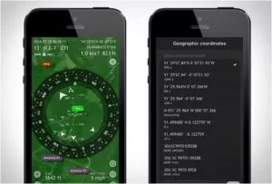
Spyglass is a feature-rich iPhone GPS app designed for expert outdoor sportspeople. It offers an array of tracking features, including a mil-spec compass, gyrocompass, real-time viewfinder, tactical GPS, speedometer, altimeter, and a sextant with a rangefinder. By utilizing your phone’s camera and hardware sensors, Spyglass calibrates precise positional information.
Pros:
- Tracking Features: Offers a comprehensive set of tracking features, including compasses, GPS, speedometer, altimeter, and sextant with a rangefinder.
- Distance Measurement: Allows users to measure the distance between two objects accurately.
- Celestial Navigation: Utilizes the location of the moon and stars to assist with navigation.
- Positional Calibration: Uses the phone’s camera and sensors to calibrate precise positional information.
Cons:
- Steep Learning Curve: The numerous features can be overwhelming for beginners.
- Expert Level App: Spyglass is tailored for experienced outdoor sportspeople, which may not be suitable for casual users or those with basic navigation needs.
13. Citymapper
Price: Free
Main benefits: Travel options based on time, cost, and energy
Available on: iOS, Android

Citymapper is a leading navigation app with a mission to make cities more accessible. It excels in providing directions via public transportation, but unlike similar apps, it supports planning journeys with any mode of transport. A standout feature is the ability to view the status, destination, and estimated arrival time of trains or buses, along with other helpful information.
The app’s limitation is its availability only in major cities with high tourist and commuter traffic. However, users have the opportunity to vote for the next city to be added through the website. Citymapper is the ultimate choice for commuters.
Pros:
- Comprehensive Transit Information: Citymapper provides extensive transit information for various transportation modes, allowing users to plan their journeys efficiently.
- Seamless Multi-Modal Integration: The app seamlessly integrates different modes of transportation, enabling users to combine and switch between them for optimal routes.
- Real-Time Updates: Citymapper offers real-time updates on transit delays and disruptions, keeping users informed and allowing them to adjust their plans accordingly.
- User-Friendly Interface: With its user-friendly interface, Citymapper ensures easy navigation and a pleasant user experience.
Cons:
- Limited Coverage in Smaller Cities: Citymapper’s coverage is primarily focused on major cities with high tourist and commuter traffic, which may limit its availability in smaller cities or less developed regions.
- Data Connectivity Dependency: To provide real-time updates, Citymapper relies on data connectivity. This means that users need a stable internet connection for accurate information.
- Potential Coverage Gap: In comparison to more widely used navigation apps, Citymapper may not offer the same level of coverage in terms of supported cities and regions.
Conclusion:
In the mesmerizing realm of GPS navigation apps, a world of accurate directions and enchanted routes unfolds. With these magical companions by your side, you’ll never lose your way in the labyrinthine streets of the city. Picture this: real-time traffic updates whispering secrets of congested roads, guiding you towards open paths like a mystical oracle. And lo! A voice, soft and melodious, leads you through the twists and turns, freeing your eyes to soak in the wonders of the world.
And when your odyssey is complete, these magical companions immortalize your adventures, allowing you to plan, share, and weave tales of your triumphs. So, heed the call, brave traveler, and embrace the wonders of GPS navigation apps as you embark on your next extraordinary voyage.
Learn more about the latest developments in the tech biz here.
FAQs on GPS and Navigation Apps:
Can I use navigation apps for driving, walking, and public transportation?
Yes, most navigation apps offer support for driving, walking, and public transportation. They provide turn-by-turn directions, estimated travel times, and route options based on the selected mode of transportation.
Can I customize the voice prompts and map settings in navigation apps?
Yes, navigation apps often provide customization options. Users can typically choose from different voices for voice-guided directions and adjust map settings such as map orientation, color schemes, and display preferences.
Can navigation apps be used offline?
Some navigation apps offer offline functionality, allowing users to download maps and directions for a specific area. This enables navigation even when there is no internet connection available.
Can navigation apps help me find nearby points of interest (POIs) like restaurants or gas stations?
Yes, navigation apps often include features that help users locate nearby points of interest, such as restaurants, gas stations, hotels, ATMs, and more. These POIs are typically displayed on the map or can be searched for within the app.
Are navigation apps available in multiple languages?
Yes, many navigation apps offer support for multiple languages. Users can choose their preferred language for the app’s interface and receive directions in their desired language.
How do navigation apps handle privacy and security concerns regarding user data?
Navigation apps generally have privacy policies that outline how they collect, store, and use user data. It is important to review these policies and understand the app’s data handling practices. Users can often adjust privacy settings within the app to control data sharing.
